
Onslow ZIP Code Coverage
The county's ZIP and place inventory identifies 19 ZIPs that appear in Onslow County material. It is a useful starting list, not a statement that any one postal area lies wholly inside the county. The delivery-name column preserves the place context in that county source. Use the USPS address tool and the county GIS layer before treating a mailing label as a post-office, city, or county answer. That distinction is especially important for rural routes, coastal communities, installation areas, and ZIPs that meet a neighboring county.
| ZIP | Areas Covered | Post Office / Delivery Name | Notes |
|---|---|---|---|
| 28445 | Holly Ridge area | Holly Ridge | Also associated with Pender County. |
| 28454 | Maple Hill and rural edge | Maple Hill | Pender County and rural cross-county context. |
| 28460 | Coastal community | Sneads Ferry | Local Onslow coastal community. |
| 28518 | Small Onslow portion | Beulaville | Primarily a Duplin County context. |
| 28521 | Minute Onslow portion east of OAJ | Chinquapin | Primarily a Duplin County context. |
| 28539 | Local community area | Hubert | Local Onslow ZIP. |
| 28540 | County-seat area | Jacksonville | Jacksonville delivery area. |
| 28541 | Separate Jacksonville delivery area | Jacksonville | Verify each address through USPS. |
| 28542 | Installation-associated area | Camp Lejeune | Delivery clue, not evidence about an individual. |
| 28543 | Installation-associated area | Tarawa Terrace | Verify the address and jurisdiction. |
| 28544 | Midway Park, Piney Green, Jacksonville | Midway Park / Piney Green | Several named delivery communities. |
| 28545 | Installation-associated area | McCutcheon Field | Verify the address and jurisdiction. |
| 28546 | Separate Jacksonville delivery area | Jacksonville | Verify each address through USPS. |
| 28547 | Installation-associated area | Camp Lejeune | Delivery clue, not a household record. |
| 28555 | Community area near county edge | Maysville | Also connected to Jones County. |
| 28574 | Local community area | Richlands | Local Onslow ZIP. |
| 28582 | Rural area north of Swansboro | Stella | Carteret County context. |
| 28584 | Swansboro area | Swansboro | Carteret-border context. |
| 28585 | Mostly Hoffman Forest area | Not identified in county table | Jones County context. |
Mailing areas can overlap even when the local government does not. A result for a town name should lead to an address check, not a claim that every parcel or record belongs to that town. The county table also leaves the delivery name blank for 28585, which is a good reason to avoid filling in a post-office name from guesswork. Use the address-specific result, its date, and the GIS boundary layer when a record request depends on jurisdiction.
Onslow Cross-County ZIP Codes
Several ZIPs in the county inventory require a county-line check before a records search. Holly Ridge 28445 and Maple Hill 28454 connect to Pender County. Beulaville 28518 and Chinquapin 28521 have Duplin County context, while Maysville 28555 has a Jones County connection. Stella 28582 and Swansboro 28584 sit near Carteret County context, and 28585 is described mostly with Hoffman Forest and Jones County. Those overlaps affect which Register of Deeds, court, elections office, or tax office may hold the record.
The address itself is the deciding fact. A Maple Hill mailing address, for example, does not by itself tell you which county recorded a deed or manages a voter registration. Check the parcel against the Onslow County GIS map service, then use the county line and city-limit layers with the returned site address. For court, birth, marriage, or property questions, route the request to the custodian for the event or parcel, not simply the county printed beside a ZIP.
Note: A postal place label can cross a county line, so save the verified street address and the date of each search.
Jacksonville Delivery-Area ZIP Codes
Jacksonville appears in several delivery areas: 28540, 28541, 28544, and 28546. The county inventory also separates Camp Lejeune, Tarawa Terrace, and McCutcheon Field into 28542, 28543, 28545, and 28547. These codes can narrow a broad address search, but they do not reveal who is at an address, whether a person is connected to an installation, or which custodian holds a particular record. Installation and civilian records have separate custodial systems.
Address history adds another limit. The city grew around Wantland's Ferry, was incorporated in 1842, and was laid out in 1849, according to the City of Jacksonville history. Camp Lejeune growth in the 1940s changed the population and street context, and Jacksonville annexed portions near Camp Lejeune in 1990. An old Jacksonville entry can therefore fall outside present city limits or use an address pattern that does not match a current parcel. Pair older entries with deeds, plats, and the GIS address record.
Verify Onslow ZIP Codes
USPS offers three useful checks: find a ZIP by street address, find a ZIP from city and state, and find cities served by a ZIP. The address mode requires a street and either city and state or a street plus ZIP. USPS says its result does not confirm that a person or business is at an address. It is a delivery check, not a resident record, and it should be saved with the exact address and the date searched.
The USPS ZIP Code basics material describes standardized addressing and the postal database update cycle.
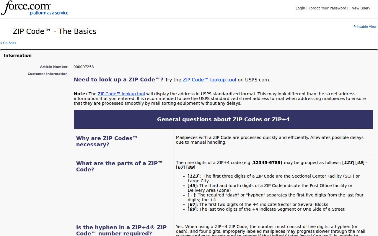
USPS reports that its national delivery database changes on a roughly 30 to 60 day cycle, so a prior result should be checked again when an address is material to the search.
- ZIP and ZIP+4
- A ZIP identifies a delivery area. ZIP+4 adds a smaller delivery segment for a more precise mailing address.
- PO-box ZIP
- A postal ZIP used for post-office boxes can differ from the ZIP used for street delivery.
- Unique ZIP
- A ZIP assigned to a single organization or delivery setting is not a general map of nearby residences.
- Carrier route
- A carrier route is a mail-delivery sequence within a postal area, not a legal neighborhood or municipal boundary.
Find Residents by Onslow ZIP
No inspected Onslow public portal provides a complete resident-by-ZIP roster. The Tax Bill Search has a Property Address field but no dedicated ZIP field. The GIS viewer supplies an address contains search and a ZIP boundary layer, while the live voter form narrows by county rather than ZIP. The residential permit service does expose a ZIPCODE attribute, but a permit is an address-history lead, not a list of everyone who lives there. A careful ZIP search joins these limited sources instead of treating one result as a household list.
- Confirm the full delivery address with the USPS lookup, including the city and state returned for that address.
- Search the address in the Onslow GIS viewer, turn on the ZIP, county, and city-limit layers, and record the parcel or PIN shown.
- Use the returned property address, parcel, or account in the Tax Office search. Compare the assessment record with the map because a tax label is not a deed conclusion.
- Use the permit layer only when its ZIPCODE, Main_Address, and date fields match the address. For voter information, use the official name-and-county lookup or the Board of Elections route, not a presumed ZIP filter.
Once the ZIP is narrowed to a particular road, the Onslow Street Directory has the address-based workflow for GIS, tax, and recorded-property checks. That work is more reliable than trying to infer a street list from a postal area alone. The Tax Office can also help with property-search questions at 910-989-2200, while the map and tax data should still be compared with recorded instruments when ownership matters.
Note: A voter result can confirm registration geography, but it does not establish household membership or current ownership of a parcel.
Onslow ZIP Layers and Downloads
The county map service includes ZIP Codes alongside parcels, city limits, county boundary, structures, E911 streets, zoning, flood zones, townships, schools, parks, Camp Lejeune, and Hoffman Forest. Those layers answer different geographic questions. Start with the ZIP boundary to test delivery geography, then turn on the parcel and jurisdiction layers before deciding which local office may have the record. The county warns that GIS updates can lag behind recording, so a new transfer, split, or address change may require a follow-up with the deed or tax source.
The Onslow GIS map service is the source for the county's public ZIP and jurisdiction layers.
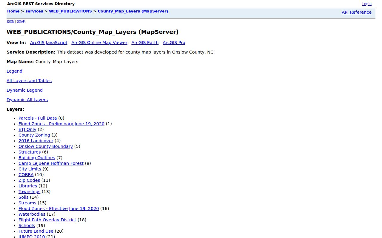
The service view helps separate a mapped ZIP boundary from city limits, parcel outlines, and the county edge before a records request is sent.
The Onslow GIS download catalog also lists address, centerline, city-limit, zoning, parcel, township, fire-district, and flood-zone files. Its file names carry update months or years, so record the displayed file date before relying on a download. A dated file is useful for checking the geography at one point in time, but it is not proof that a delivery record or ownership record has stayed unchanged.
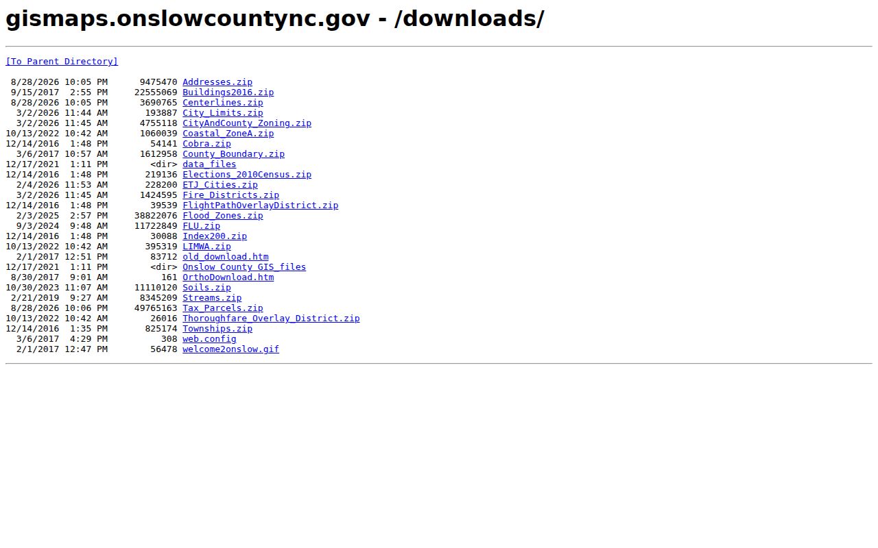
The catalog gives a practical second access channel when the interactive map is slow or when a search needs a dated address or city-limit layer.
Onslow Permit ZIP Fields
Onslow's residential permit ArcGIS layer provides a narrow ZIP-based record path. It carries ZIPCODE with Main_Address, CITY, TOWNSHIPS, YEAR, DATE, Issue_Date, Permit_Status, Permit_Number, and Work_Class fields. The service supports query, pagination, and advanced-query operations, with a 2,000-record maximum per query. It can help place an address in a time frame or locate a permit record, but it is not a complete people record and may reflect a permit applicant rather than all occupants.
The residential permit layer shows the ZIP-related fields available in this public ArcGIS service.
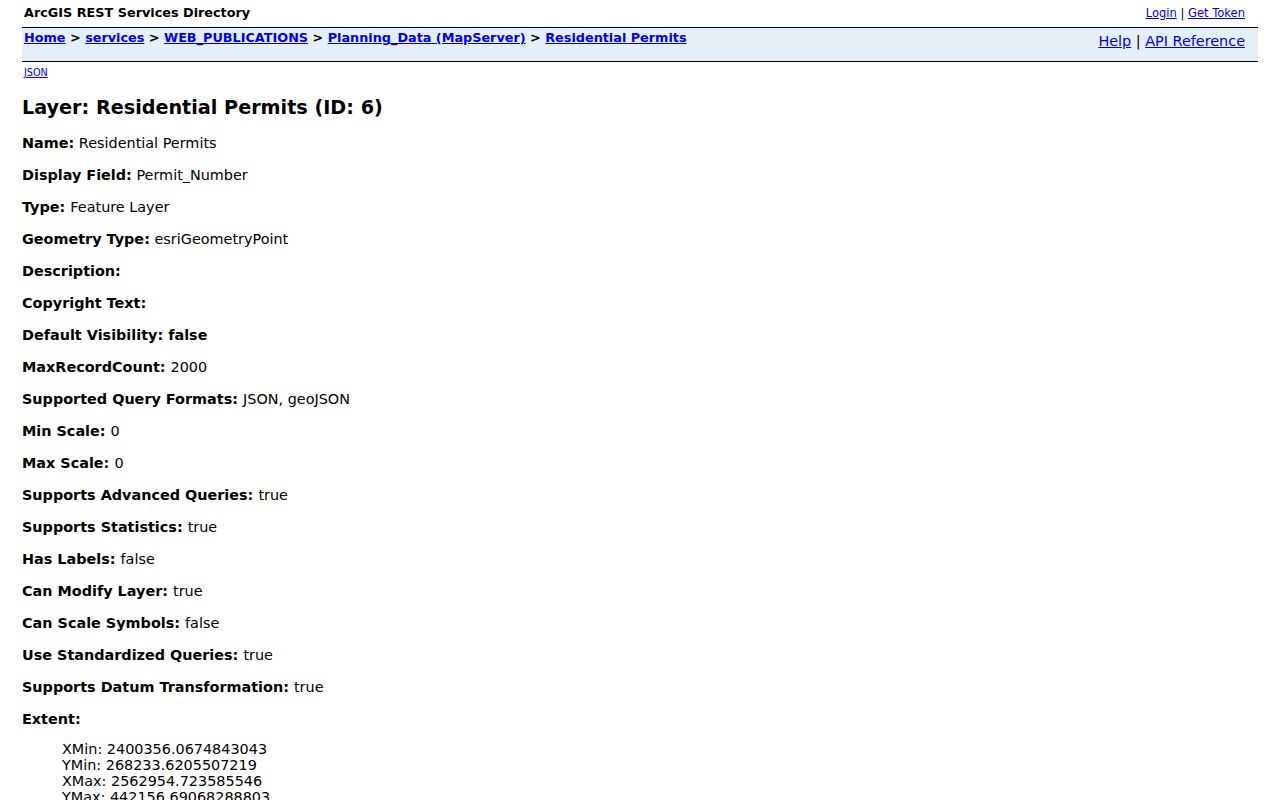
Match the service's address, ZIP, and date values to a GIS parcel before using a permit entry as an address-history lead.
| Field Label | Type | Required | Options / Format Notes |
|---|---|---|---|
| ZIPCODE | Service attribute field | Not stated | ZIP attribute supplied with the permit record. |
| Main_Address | Service attribute field | Not stated | Use with ZIPCODE to compare the property location. |
| CITY | Service attribute field | Not stated | Delivery-city context only, not a jurisdiction finding. |
| TOWNSHIPS | Service attribute field | Not stated | County geographic context. |
| YEAR | Service attribute field | Not stated | Year field made available by the layer. |
| DATE | Service attribute field | Not stated | Date field made available by the layer. |
| Issue_Date | Service attribute field | Not stated | Permit issue-date field. |
Onslow ZIPs and City Limits
A ZIP is delivery geography, while a city limit is a government boundary. In Onslow County, a Jacksonville address can be inside the city, in its extraterritorial jurisdiction, or in unincorporated county. A Camp Lejeune ZIP is also a delivery clue rather than proof of a particular barracks, family unit, or military connection. Before routing a permit, code, tax, court, or records question, compare the address against the parcel's governmental layer and the county boundary.
The county's coastal and river geography makes that comparison practical, not academic. The Onslow County history describes communities across river, sound, ocean, rural inland, base, and county-seat settings. The New River's headwaters and mouth both lie in the county, a local geographic fact that helps explain why postal place names, municipal lines, and service areas do not always line up. For a boundary-sensitive question, retain the map layer, search date, and address used.
ZIP Clues for Onslow Families
For family history, a postal label is a starting point for an older address, not the end of the search. Normalize the address with USPS, then compare the modern GIS location with deeds, plats, and the historical city-directory material held through Onslow County sources. A Jacksonville listing from an earlier period may predate later street changes or annexation. Preserving the printed place name, ZIP check date, directory year, and parcel reference makes it easier to explain why an older listing and a current map do not match exactly.
This approach serves a practical family question without publishing a roster of occupants. It also keeps the source trail clear: postal delivery verification, mapped location, recorded land history, and historical directory evidence each answer a different part of the address question.
Note: Keep publication, recording, map-update, and USPS verification dates separate because they describe different stages of an address record.