
Work a Street in Onslow County
An Onslow County street directory search begins with the normalized street name, not a guess about who occupies every building. Search the physical address in GIS, note the parcel or PIN, and compare the Tax Office card. Then use the Register of Deeds to identify the recorded instrument that relates to that parcel. The sequence separates map, assessment, and legal-record roles. It also leaves room for a newer address, parcel split, or city-limit issue that changes which office controls a permit or code record.
- Search the address in the GIS viewer, using the street name and number as displayed.
- Record the parcel, PIN, physical address, map layers, and the date of the search.
- Run the same address, owner name, parcel ID, or account in the Tax Office search.
- Use the parcel or deed book/page clue in Register of Deeds eSearch and read the recorded image.
- Check voter registration only for its limited public registration context, then use dated library sources for an older street question.
Each step adds a different kind of evidence. An assessment owner label is not a deed conclusion, and neither record identifies all occupants of a street. Keep the search date with each result.
Onslow County GIS by Street
The Onslow GIS Mapping System is the county address bridge. Its site-address field is called PHYSICAL_ADDRESS and uses contains-text logic. Owner search expects the form Last,First with no space after the comma. The viewer also accepts a 15-digit PIN, a normally seven-digit parcel ID, and current deed book/page clues. Autocomplete can be selected, or Enter can run a wildcard search.
The GIS viewer help page shows the documented tools and search patterns.
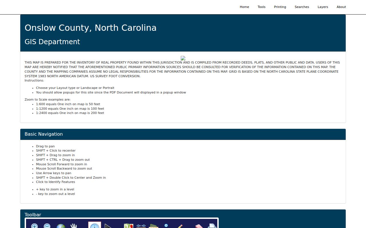
The help material supports an address-to-parcel workflow. It does not turn the viewer into a list of every person connected with a street.
| GIS field or tool | Street-directory use |
|---|---|
| PHYSICAL_ADDRESS | Contains-text address search for a normalized street. |
| Owner | Uses surname, comma, given name format. |
| PIN | Searches a 15-digit parcel PIN. |
| PARCELID | Searches the normally seven-digit parcel identifier. |
| Adjoiners | Shows touching parcels around a selected parcel. |
| Neighborhood Parcels | Uses a neighborhood code, not a membership list. |
Onslow County Street Records
Address-keyed sources have different strengths. GIS is the first authority for mapped addressing and its geographic layers. Tax is an assessment inventory. The deed image is the legal-record trail. The county permit layer adds an address-linked construction or inspection history. A voter result is registration information, not proof that a property owner or voter currently shares a street address with someone else.
| Address source | What it shows | Onslow custodian | Access |
|---|---|---|---|
| GIS viewer | Physical address, parcels, map layers, and adjoining parcels | Onslow GIS | Public viewer |
| Tax property search | Assessment owner label, account, tax year, and situs address | Tax Office | Public portal |
| ROD eSearch | Recorded documents and book/page or name paths | Register of Deeds | Guest or account route |
| Permit layer | Main address, status, work class, date, city, ZIP, and township fields | County permit and GIS services | Public map and portal |
| Voter Search | Registration-related geography | NC State Board of Elections | Public name search |
For an address inside Jacksonville, verify the city limit or ETJ before sending a code question. Jacksonville’s report-a-violation form directs users to its interactive map and points people outside its jurisdiction to county code enforcement or the correct municipality.
Onslow County Tax Search Fields
The Tax Bill Search accepts several ways into an address record. An owner name can start the search, while an account number, parcel ID, alternate parcel ID, bill number, selected tax year, or property address can refine it. The result is valuable for an assessment trail, but the county says its property data should be checked against recorded deeds, plats, and other source material.
The Tax Bill Search form shows the exact public controls captured for Onslow County.
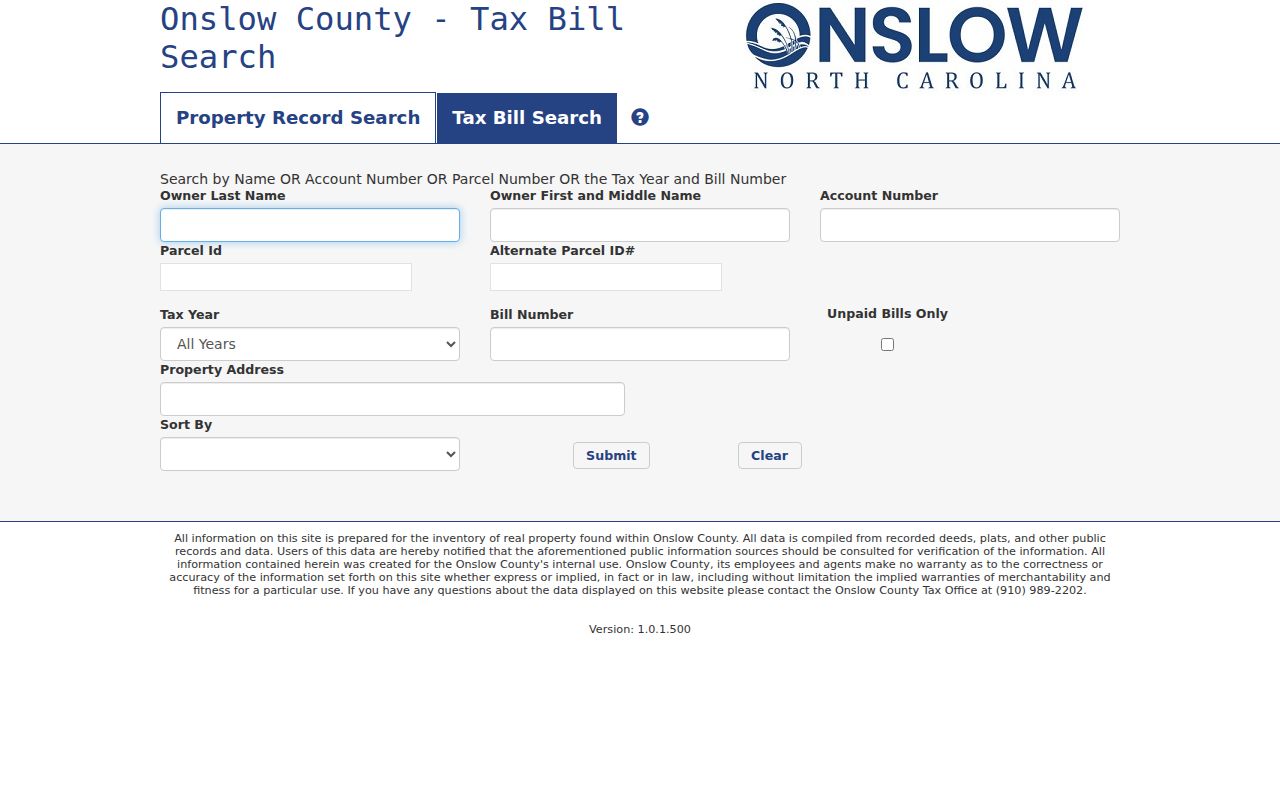
Searching by property address helps locate the assessment card. A different mailing address on that card should not be treated as the situs address or as an occupancy statement.
- Parcel
- A land unit represented on the county map.
- Situs address
- The physical property address, which can differ from a mailing address.
- Plat
- A recorded map that can define lots, boundaries, and subdivisions.
- Criss-cross directory
- An address-arranged directory when the repository confirms that it holds one.
Onslow County Deed Trail
An address is not a legal description. After GIS supplies a parcel, use that clue to reach the Register of Deeds eSearch path. The Register’s FAQ identifies Indexed Records, Quick Name, Advanced Name, Property, Book/Page Number, File Number, Date Range, Pre-1976 Dates, and Certified Dates. A Property search can be a lead, but direct book/page and grantor-grantee review are safer when the question concerns a particular instrument.
The Certified Dates display identifies the search windows behind the Register paths.
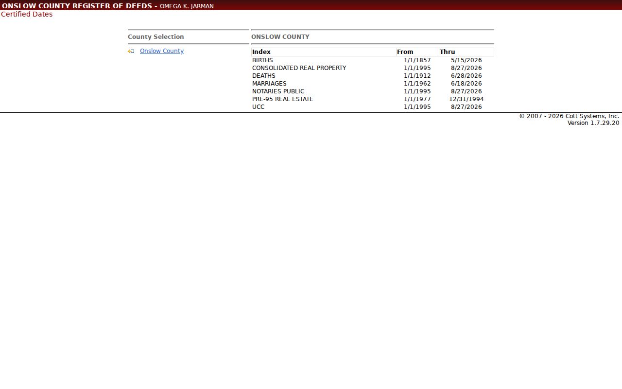
The county reports deed books from 1734 onward as viewable online, even though modern real-property index paths start later. When an older street label or number does not match a current map, compare the recorded legal description, plat, and dated directory evidence before joining it to a modern parcel.
Onslow County Address Maintenance
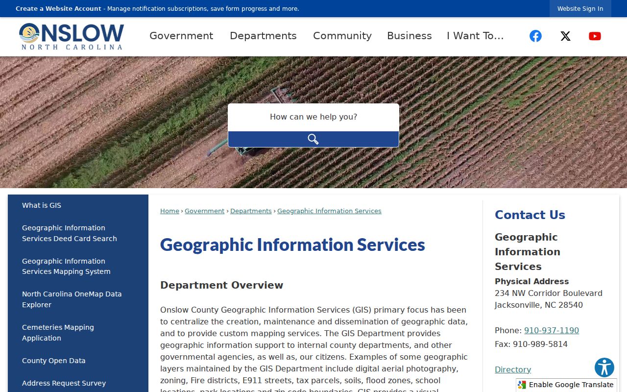
GIS maintains county property addresses, E911 streets, parcel mapping, and updates sent to USPS, E911, and tax records. It also processes deed transfers, subdivisions, and parcel splits. The department warns that recorded changes can take time to appear online. A very new address, a split parcel, or a changed street range may therefore need a direct question to GIS rather than an assumption based on a blank map result.
The Onslow GIS department page describes the countywide maintenance role.
Jacksonville has its own municipal addressing framework under Unified Development Ordinance section 5.13. That rule governs the municipal system, while county GIS, E911, and other municipalities can have separate responsibilities.
Note: For a new or missing address, ask GIS or the relevant planning office how it handles correction instead of inventing a standardized street form.
Onslow County Street Map Context
The GIS map services include E911 streets, centerlines, building outlines, structures, city limits, ETJ, zoning, fire districts, flood zones, schools, parks, and ZIP layers. These layers explain why a street search can return an address with a different mailing place or government jurisdiction. A Jacksonville mailing name may sit in the city, in an ETJ, or in unincorporated Onslow County. Coastal and county-line ZIP areas need the same check.
Use the viewer’s Adjoiners tool for parcels that touch the selected parcel and Select by Location for a specified buffer. Those map relationships are useful for block context, but neither tool identifies household membership. Street View is an orientation feature, not official evidence about an address or person.
When a search reaches a permit or code question, identify the jurisdiction before asking for records. The county Citizen Access portal advertises searches for permits, plans, inspections, code cases, requests, licenses, and a neighborhood map. Its residential ArcGIS layer uses fields such as main address, permit status, work class, issue date, city, ZIP, and township. Inside Jacksonville city limits or its ETJ, the city’s own planning and code routes may control the file. Outside that boundary, a county office or another municipality may be the right contact. Map layers make that routing decision visible before a request is made.
Onslow County Street Permits
Permit information can add an address-linked event to a street directory search, especially for an unincorporated parcel. Onslow Citizen Access advertises public searches for permits, plans, inspections, code cases, requests, and licenses, along with a map described as showing neighborhood activity. Its county tutorial identifies Dashboard, Home, Apply, View, Map, Help, and Search tabs and lists residential mechanical and electrical categories. The exact live filter set was not exposed during research, so use only the options shown on the current official portal.
The county’s residential permit ArcGIS layer supplies more specific record labels: Main_Address, Permit_Status, Work_Class, Issue_Date, city, ZIP, and township. Those fields can place a permit in time and at an address. They do not identify every person using the structure, and a permit applicant can be an owner, contractor, or other recorded role. Search the record as an address event, then consult the responsible planning office if an official copy or older file is needed.
Onslow County Street Index Coverage
The Register’s Certified Dates tool gives a practical warning about historical street work. It lists pre-95 real estate from January 1, 1977 through December 31, 1994 and consolidated real property from January 1, 1995, while the county says deed books run from 1734 to the present. A modern property or address search may therefore be convenient only for part of a long address history. Earlier material can still require a deed book, book/page reference, older surname, plat, microfilm, or State Archives request.
The eSearch login offers guest access, but browser settings, pop-up handling, and PDF viewing can affect image access. A notice captured in the research says PropertyCheck is moving to RecordHub after May 4, 2026. Record the portal name and access date with a street search, especially when a saved route no longer produces the same screen or gives a different document path.
Onslow County Historical Streets
For a past street question, work from the address backward. The Tucker Littleton Room holds Jacksonville newspapers from 1938, telephone books from 1957, city directories from 1960 through 2019, census material, microfilmed deeds, tax lists, and other local records. DigitalNC adds a 1948 Jacksonville directory. The library did not identify a particular reverse-directory volume in the examined material, so ask staff for reverse, criss-cross, cross-reference, or address-directory holdings rather than claiming one exists.
Where no reverse volume is available, read the ordinary street section, pair it with dated newspapers or telephone books, then compare the parcel and deed trail. The historical collections are described in more detail in the Onslow County directory book.
Jacksonville’s growth after the Camp Lejeune decision changed the local street and address context, while the city later annexed areas near the installation. Older addresses can therefore need a date-matched directory, plat, or deed description before they are connected to a present map label. The same caution applies around a municipal boundary or a ZIP that reaches beyond the county.
Limits of Onslow County Street Results
An Onslow County street directory cannot provide a complete, current household list. Tax and deed records concern land and instruments. GIS maps addresses and parcels. Voter access has statutory exclusions and protected-address exceptions. Utility customers, motor-vehicle data, sealed court material, protected survivors, and people who are not in a public source will not appear as a street result. A blank result can also reflect spelling, a portal change, a new address, a parcel split, or a jurisdiction boundary.